Hawaii
Highways Road Photos -- Lava Closures (page 2 of 2)
Updated July 23, 2010
This is page 2 of a photo collection on roads and highways near the
Kilauea volcano on Hawaii's Big Island, which are or used to be closed
by that volcano's lava flows. Page 1
covered past and present lava closures of Chain of Craters Road in Hawaii
Volcanoes National Park, as well as providing a lava closure area map and
other introductory information. The photos below are of lava closures of
highways east of the park (portions of state route 130, and county route
137), including some historic closure photos from the Hawaii Volcano Observatory.
Also included are photos of the mostly unpaved access road built over the
old state highway 130 right of way, initially restricted to residents and
landowners in the lava closure area, then briefly converted into a 2.6
mile long county-operated "Kalapana Safe Viewing" gravel toll road to provide
a safer alternative for tourists to watch lava flows. At the bottom of
this page are links to related sites, and to other parts of the Hawaii
Highways road photos collection.
Many of the photos below are from a May 19, 2000 tour of active
lava flows from the Kilauea volcano, near the former eastern coastal entrance
to Hawaii Volcanoes National Park. The tour was led by a couple living
in the closure area, who drove us in a 4x4 over the then very rough access
road carved into the lava, and then took us on a long hike from the northeast
roughly following the old route 130 alignment to the coast, between specacular
lava flows into the ocean about ¾ mile apart at Waha'ula
and Kamokuna. Most of the other photos are
from my November 2001 tours of the Kalapana Safe Viewing toll road, with
a smoother gravel surface, over the same alignment (except past mile 2.6,
where the part of the access road that had reached what little remains
of the Royal Gardens subdivision was re-covered by new lava flows earlier
in 2001, and as far as I know has not been rebuilt).
The old access road, while closed to the general public, was often
used by hikers (and also illegally by non-resident motorists) to view lava
flowing into the ocean. In response to injuries and occasional fatalities
among hikers on unguided tours of the lava fields, in summer 2001 the county
improved the road and opened it to the general public, along with a marked
trail to guide tourists to safe lava flow viewing areas. The improved road,
while still slow (10mph speed limit), was unlike the old access road safe
for most cars. For a few months, the toll road and the lava flows near
its end were very well-visited, and among the few bright spots in post-9/11
Big Island tourism.
In April 2002, after Kilauea's lava flows shifted several miles to
the west, and hikers seeking lava views started hiking instead from the
national park's Chain of Craters Road, the county closed the toll road
to the general public. Access was once more restricted to local residents
and landowners. However, in early 2008 the lava flows shifted back east toward the access road, and indeed cut across it at two places near its western end before the flows reached the ocean. On March 8, 2008, county officials reopened the shortened road to the general public, without tolls (for now), to a new lava-viewing area.
Notes: Some of the photos taken below came from the extensive
photo archives of the Hawaii Volcano Observatory's Kilauea eruption update.
Those photos have "HVO" in their captions, and are courtesy of the U.S.
Department of the Interior, U.S. Geological Survey.
In case you want more detail, clicking some of the photos below (for
now, just one from my 2000 trip, more from my 2001 trip, plus most of the HVO
photos) will call up enlarged, higher-quality (less .jpg compression) versions.
Those alternate versions have larger file sizes, so please be patient while
they download.

Page 1: introduction, and Chain
of Craters Road closures within national park
|
 Soon after the
current eruption of the Kilauea volcano started in early 1983, it started wreaking havoc in the
Royal Gardens subdivision, near the eastern boundary of Hawaii Volcanoes National Park and the community
closest to Kilauea. It took a few years longer for the lava to begin nibbling away at roads in Kalapana. Here, lava intrudes on an unidentified street intersection in the Kalapana Gardens subdivision in the southwestern part of Kalapana village. (HVO December 1986) Soon after the
current eruption of the Kilauea volcano started in early 1983, it started wreaking havoc in the
Royal Gardens subdivision, near the eastern boundary of Hawaii Volcanoes National Park and the community
closest to Kilauea. It took a few years longer for the lava to begin nibbling away at roads in Kalapana. Here, lava intrudes on an unidentified street intersection in the Kalapana Gardens subdivision in the southwestern part of Kalapana village. (HVO December 1986) |
 |
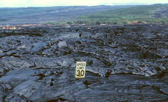 |
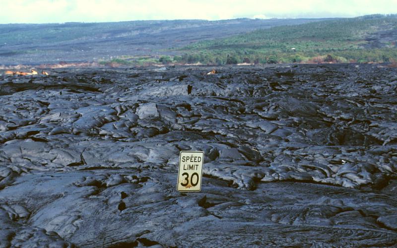
 After the
lava's initial 1986 foray into the outskirts of Kalapana village, it returned
in much greater volume in 1990, in a series of flows that wiped out most
of the rest of the village. One such flow left this speed limit sign (probably
on either state route 130 or county route 137) embedded in lava several
feet deep, surprisingly intact though also rather pointless. (HVO June
28, 1990) After the
lava's initial 1986 foray into the outskirts of Kalapana village, it returned
in much greater volume in 1990, in a series of flows that wiped out most
of the rest of the village. One such flow left this speed limit sign (probably
on either state route 130 or county route 137) embedded in lava several
feet deep, surprisingly intact though also rather pointless. (HVO June
28, 1990) |
|
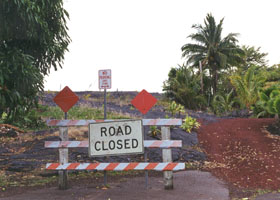
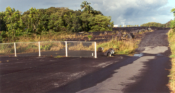
 As a result of the lava
flows that destroyed Kalapana village, county route 137 (the "Red Road")
now ends prematurely here in Kaimu, about three miles north of its original
terminus in Kalapana. During the day, there is usually a fruit stand parked
in front of the sign. (October 1999) As a result of the lava
flows that destroyed Kalapana village, county route 137 (the "Red Road")
now ends prematurely here in Kaimu, about three miles north of its original
terminus in Kalapana. During the day, there is usually a fruit stand parked
in front of the sign. (October 1999) |
 |
 |
|
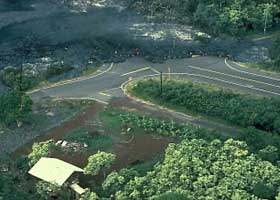
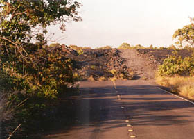
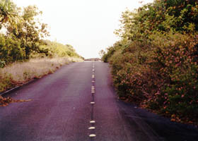
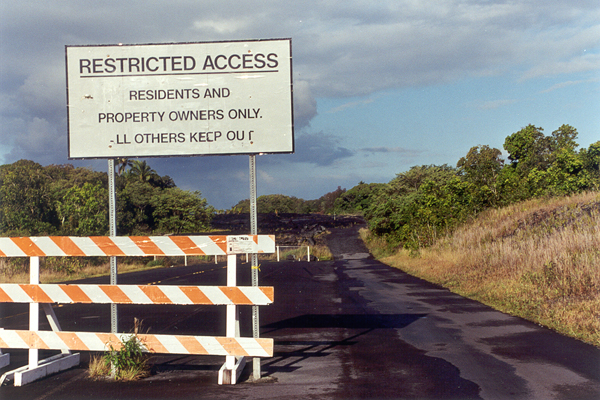
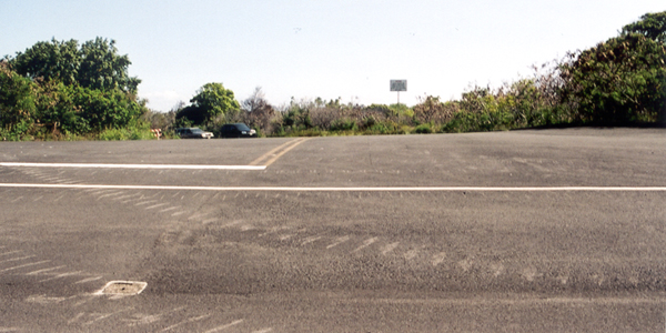
This is how state route 130 ended as of May 2000, about 3.5 miles short
of its former end at the coastal entrance to the national park. To the
right is what was the very rough and difficult (even for 4-wheel-drives)
access to what's left of the Royal Gardens subdivision and other properties
within the closure area, carved through the lava along the highway's old
alignment.
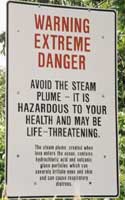
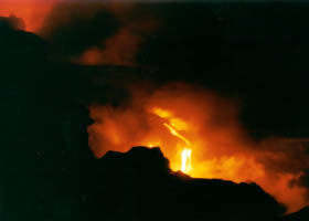
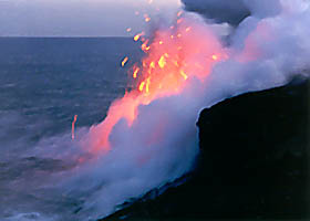
The steam rising several miles away (photo above left) marked our
tour's destination, where lava was flowing strongly into the ocean near
the former national park visitor center (on May 19, 2000 -- the flow patterns
keep changing, and lately have moved several miles to the southwest). |
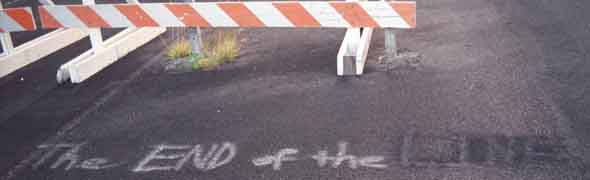 |
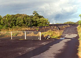
| An unofficial
pavement marking, in front of the barricade shown above. (October 1999) |
 |
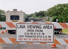 |
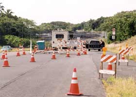
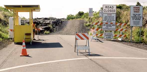
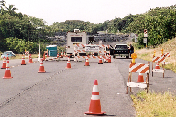
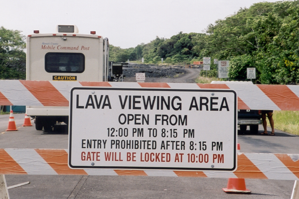
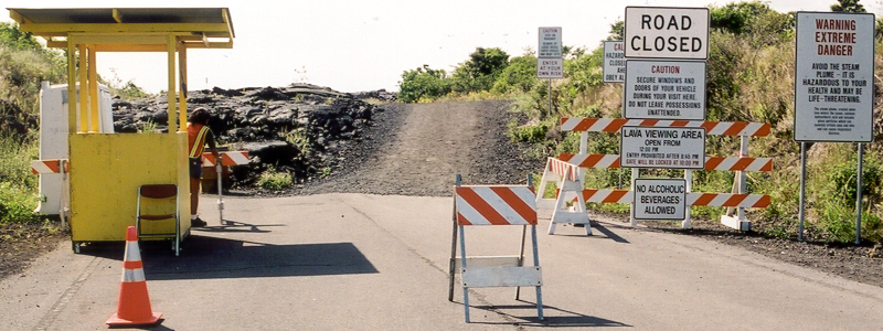
| The end of
state route 130, while the Kalapana Safe Viewing toll road was in operation.
The "mobile command post" provided tolltakers a little office space, a
place to store the brochures they handed out to visitors, and shade from
the hot sun. While the hours changed during the several months the toll
road was open, it generally stayed open each day long enough to allow lava
watchers their optimal sunset viewing times, and then a chance to hike
back to their cars in time to clear out of the area. The sign above right
notwithstanding, the residents and landowners in the lava closure area
who previously had been allowed to use the road, could continue using it
toll-free 24 hours a day. (Both photos November 2001) |
 |
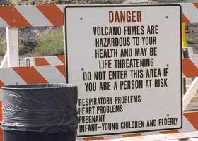 |
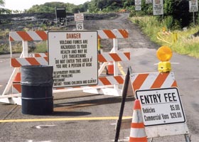
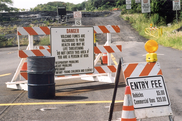
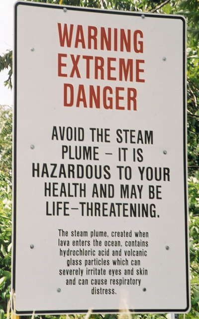
| Right after
paying the entry fee ($5 for cars, $20 for tour vans), motorists drove
onto the new gravel surface of the toll road (much kinder to tires and
suspensions than the old path carved through the lava, which was a hard
ride even for 4x4s), but not before starting through the gauntlet of warning
signs with the one shown in more detail above right. (Both photos November
2001) |
 |
  |
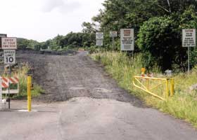
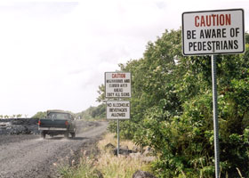
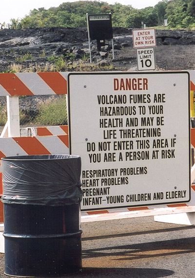
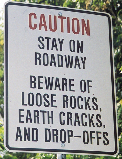
| An overview
of the rest of the warning signs, plus the 10mph speed limit for the entire
road (under an "Enter At Your Own Risk" sign). (November 2001) |
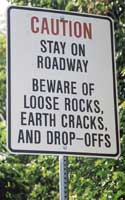
The first
two signs. (Both photos November 2001) |
 |
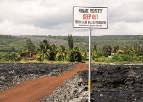
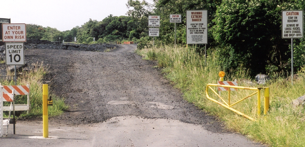
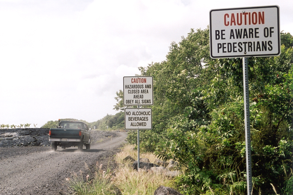
The motorists in this
truck, not discouraged by all the warnings, drive by the last two signs
at the road entrance. (November 2001) |
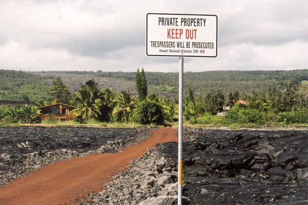
At mile 0.9 past the
end of state route 130, one of the homes still remaining in the area cut
off by the lava flows that truncated the state highway. These and other
residents along the access road have unrestricted use of the road, notwithstanding
the past and present restrictions for the general public. (November 2001) |
 |
 |
| At mile 1.3,
there's just bleak lava fields on either side of the road. In this area,
the lava is mainly "pahoehoe," relatively smooth (compared to the other
kind, jagged a'a lava), but can still
really cut you up if you fall on it. (November 2001) |
 |
 |
|
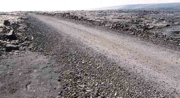
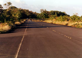
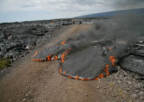
These three photos show some of old route 130's four "kipuka" within the
lava closure area (short stretches surviving the lava flows, but cut off
from the rest of the road), in May 2000 before the rough path of the restricted
access road (photo above left, starting at the right side of the pavement
break) was covered with smoother gravel for the toll road. These kipuka
are at mile 0.3-0.6, 0.6-0.8, 1.6-1.8, and 2.0-2.2. The kipuka allowed
toll road travelers to briefly zoom over smooth pavement, before slowing
back down to a crawl for the longer gravel stretches. Unlike the Chain
of Craters Road kipuka shown on Lava
Closures page 1, volcano goddess Madame Pele has not yet come back
to complete her unfinished business here, but she's starting on it, with lava starting to flow into the westernmost kipuka (shown below) on March 12, 2008, and later flows apparently obliterating the rest of that kipuka in October 2009. |
 |
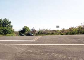
At mile 1.7, the third
kipuka includes an intersection with a side road, which might have been the coastal
"Red Road" (county route 137), closed by lava flows at Kaimu about three
miles to the north. A stub of that road survived the lava flows, and was used for overflow parking while the toll road was operating. (November 2001) NOTE: New lava flows covered this intersection in July 2010. |
 |
 |
| At mile 2.2,
at the end of the last kipuka (which was also the main parking area for
lava watchers), the remaining 0.4 miles of the road remained closed to
most vehicle traffic, and used mainly by hikers to reach the lava view
trailhead. Many of the warning signs at the road entrance were repeated
here, and/or at the trailhead. In March 2008, lava started flowing into this last kipuka, so it will be smaller and look different now if it survives at all. (November 2001) |
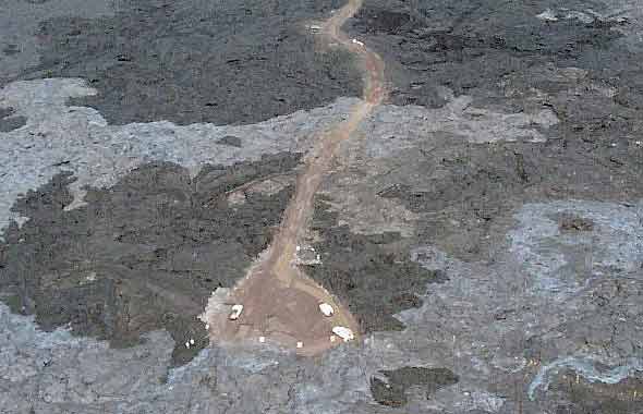 |
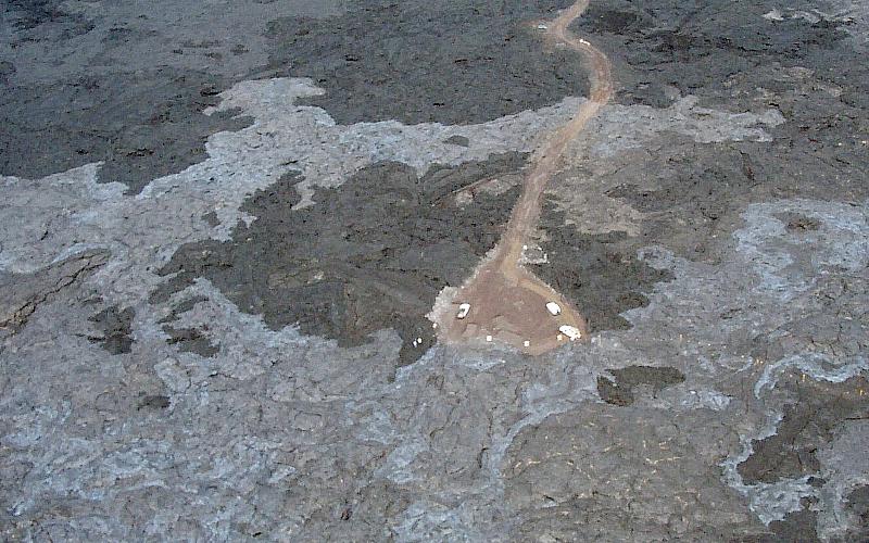
| An aerial
view from the southwest of the west end of the access road, soon after it was converted into
the Kalapana Safe Viewing toll road. This photo was taken only a few days
after the newly-opened road was briefly closed by a wayward finger of fresh
lava (the slender silvery patch near the top of the photograph), then reopened
after county engineers added a new layer of gravel on top of the lava as
it cooled. The "turnaround" was normally reserved for use as a helipad,
to evacuate injured hikers. There began the trail to lava viewing areas
near the ocean about a mile away. Some of the trail markers are visible
in the lower right corner of the above photo. (HVO September 6, 2001) |
 |
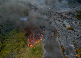 |
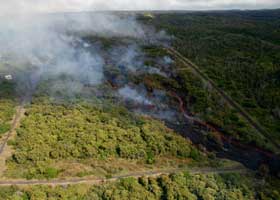
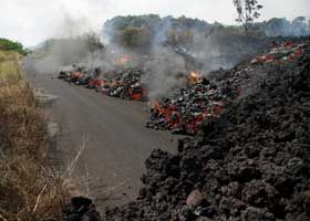
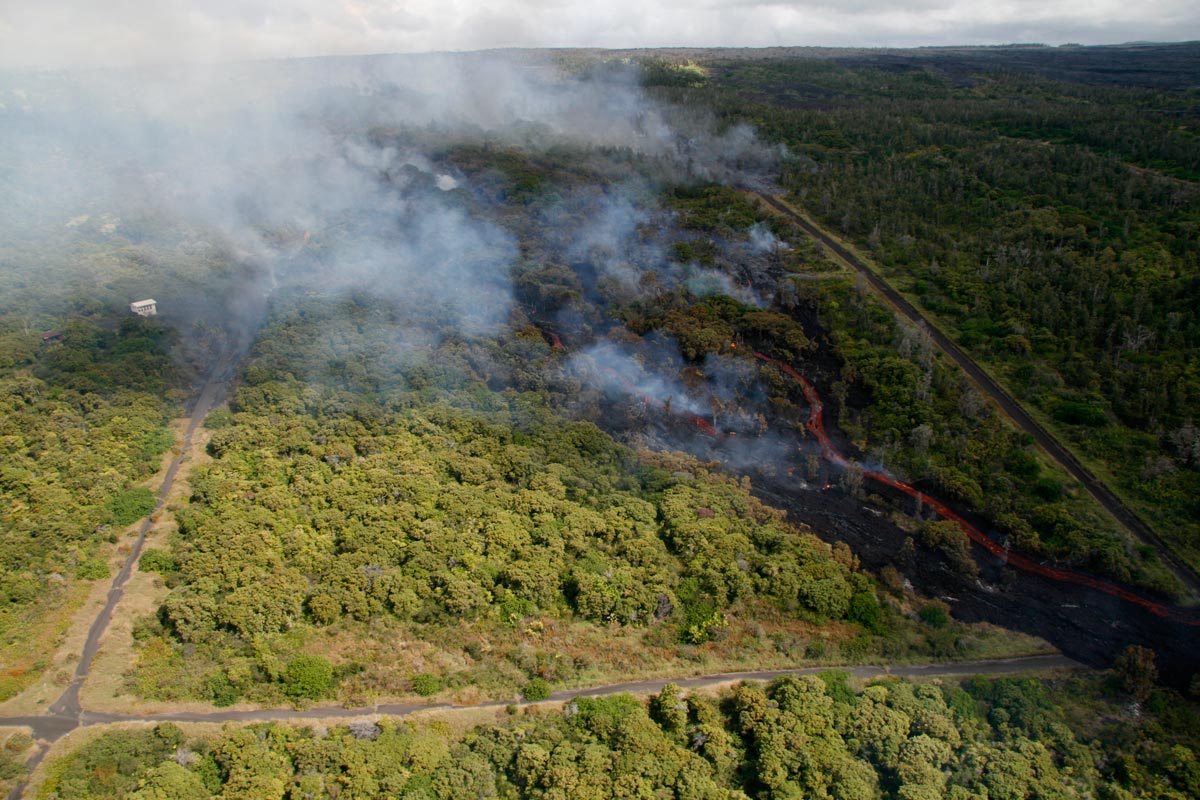
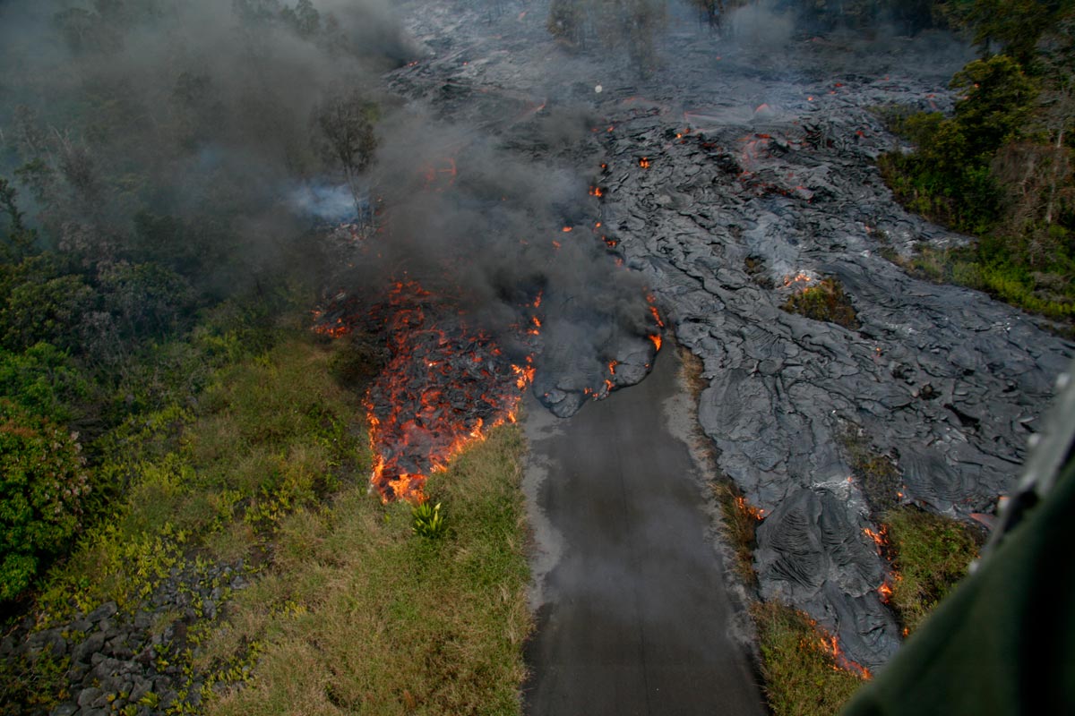
In late February 2008, lava started flowing again through the mostly-abandoned Royal Gardens subdivision northwest of Kalapana, covering some of its narrow paved streets. Above left is an overview of the damage, with lava flowing into the intersection of Royal Avenue and Orchid Street. Above right is the lava flowing down Royal Avenue, after blowing through the stop sign at the intersection with Paradise Street. Below right is a closeup of the flow of jagged a'a lava, crossing Orchid Street. (All photos HVO February 28, 2008)
|
 |
 |
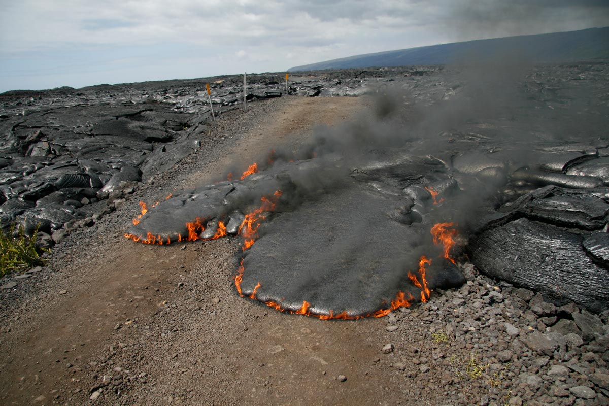
After working its way through Royal Gardens, the lava (now taking the form of smooth pahoehoe) cut across the Kalapana Safe Viewing access road in two places near its western end, before one branch reached the ocean later that day. About 2.2 miles of the road remained (apparently including all of the kipuka shown above), and was reopened to the public with restrictions on March 8, 2008 now that lava is flowing into the ocean a short distance from the road. (HVO March 5, 2008) |
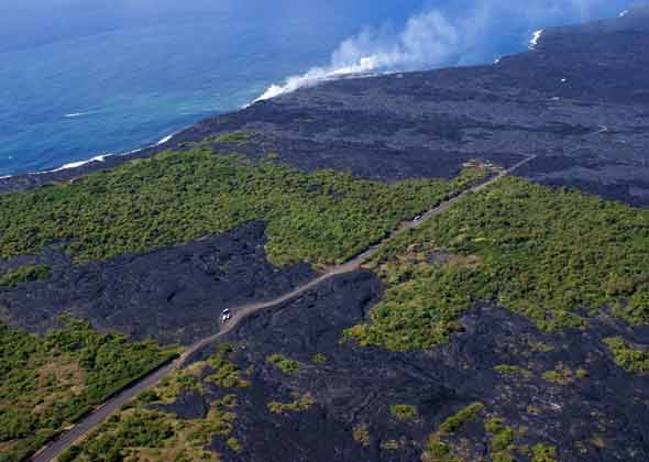 |
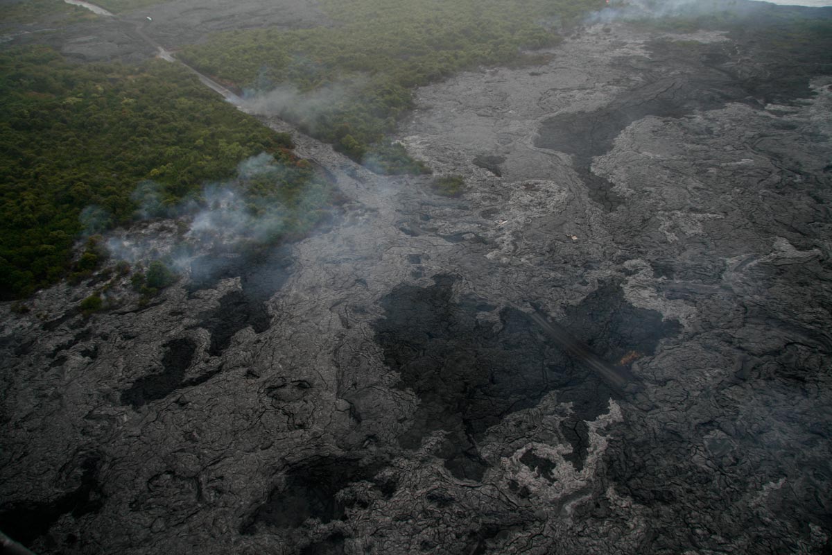
Here is a new aerial overview from the northeast of the west end of the access road, including the part now covered by solidified lava. This view includes parts of two of the remnants of old highway 130 pavement, connected by a narrower gravel segment with a pullout. (HVO March 11, 2008)
|
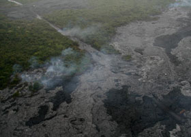
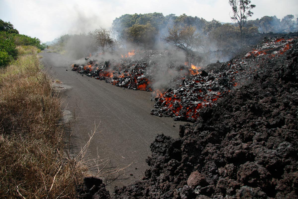
A few days later, lava started flowing down the westernmost remnant of access road pavement. (HVO March 14, 2008) |
 |
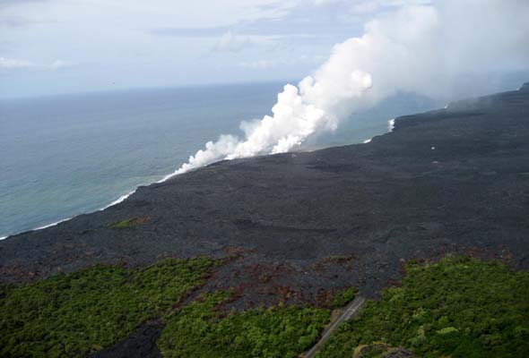 |
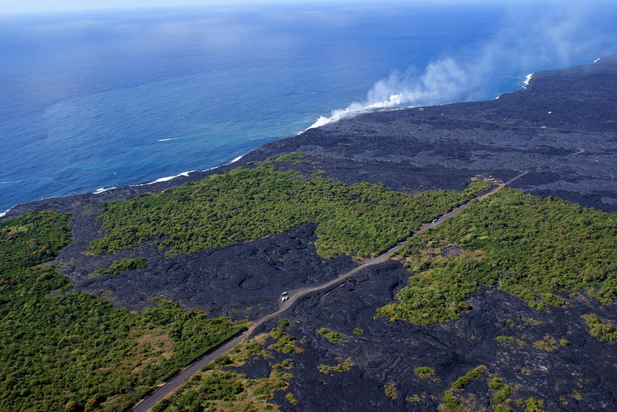
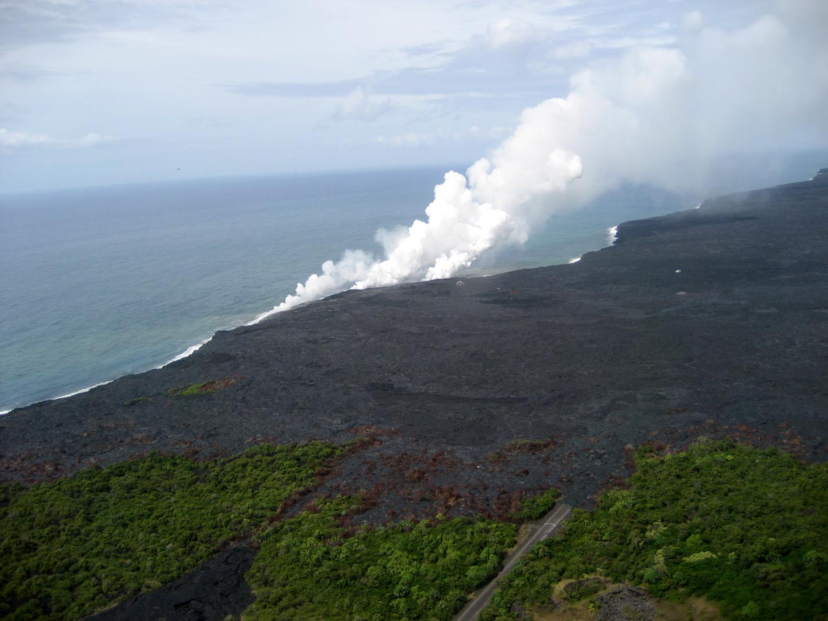
| The lava has, for now, stopped covering the access road, as shown in this aerial photo of the new west end of the road. The steam plumes indicate where lava is now flowing directly to the ocean, through underground tubes, rather than causing further havoc on the surface. (HVO May 7, 2008) |
Mark Furqueron's
Hawaii road photos page has some lava closure photos.
See also the Hawaii County lava information site for updates on lava flows and the status of the county's lava viewing access road.
or go to the previous or next parts of the Hawaii Highways road photos collection:
or directly to other parts:
Overview ·
Introduction · Interstate H-3
· Interstate H-1 · Other Freeways
Other Oahu South ·
Other Oahu West · Other Oahu East
· Kuhio Highway
Other Kauai ·
Hana Highway · Piilani Highway
· Kahekili Highway
Other Maui ·
Lanai/Molokai
· Kalawao County · Saddle
Road
Waipio Valley ·
Other
Big Island
or to other sections of the Hawaii Highways site:
Comments, etc.? Please e-mail me.
© 1999-2003, 2008-10 Oscar Voss (no copyright claimed on HVO photos,
which are in the public domain).
Last updated July 23, 2010 (note on obliteration of old route 130-route 137 intersection within fragment of old route 130). |


