Puerto Rico road trip photos - Page 2 of 2

All of the following photos are my own, from a quick trip to Puerto Rico over Labor Day weekend 2002. Most of the commentary is also my own, but Michael González, who lives in western Puerto Rico, provided helpful comments on an earlier version of these pages, some of which are incorporated below.

This page covers the termini of Puerto Rico's unsigned Interstates (PRI-1 through PRI-3), as well as some other interchanges and junctions on those highways. The first page has photos of road signs and license plates.

Puerto Rico's Interstates are not required to meet conventional Interstate standards (unlike the Interstates on the mainland and in Hawaii), per Federal legislation enacted in 1980 which also let Alaska get its own set of "paper Interstates." The majority of Puerto Rico's Interstate mileage seems to meet or come close to normal Interstate standards. Some stretches (such as parts of PRI-2 from near Arecibo to Ponce via Mayaguez, and PRI-3 from Carolina to Fajardo) are still multilane divided highways with at-grade crossings, though projects to replace them with new autopistas (toll freeways) are underway or planned.

Not only are Puerto Rico's Interstates unsigned, it is hard to tell which roads each includes, or exactly where they begin or end. I've sorted through the information on Interstate routing available from the Federal Highway Administration to determine the Interstate termini shown below, including the 1992, 2001, and 2002 editions of "The Dwight D. Eisenhower System of Interstate and Defense Highways -- Route Log and Finder List;" an on-line map showing the Interstate and other Federal-aid highway networks for Puerto Rico, with linked closeup maps of several major cities; "National Highway System Length -- 2003"; and the Office of Highway Policy Information's "Toll Facilities in the United States" (June 2003).

NOTE: In case you want more detail, clicking most of the photos below will call up enlarged, higher-quality (less .jpg compression) versions. Those alternate versions have larger file sizes, so please be patient while they download.


RETURN TO PAGE 1

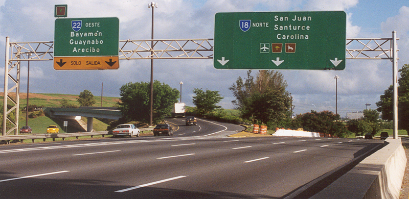
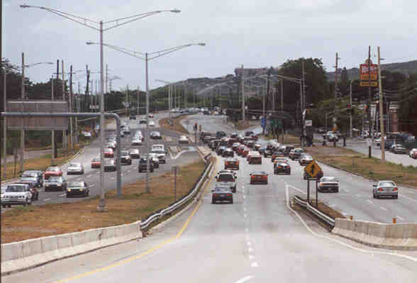
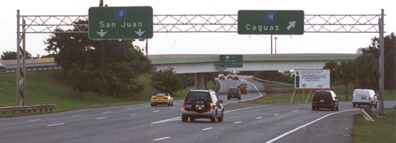
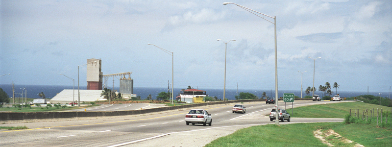
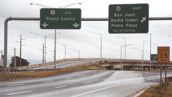
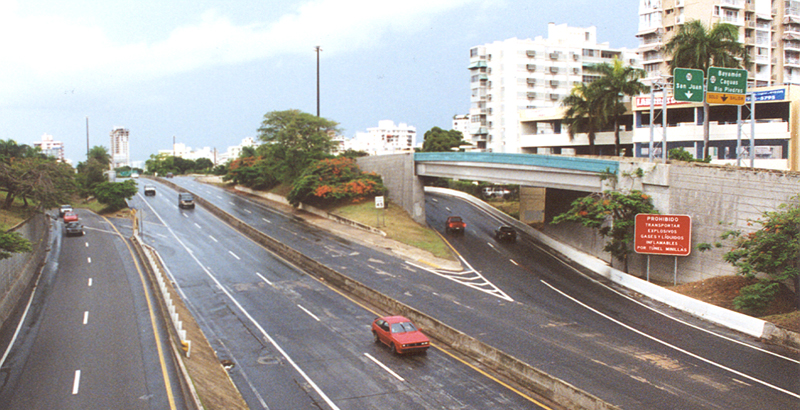
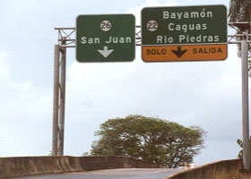
Interstate PRI-1 (San Juan-Ponce via Caguas -- PR-18 and PR-52)
North end of PRI-1, at PR-18/PR-22 junction
PRI-1's north end is here, where PR-18 joins PR-22 (PRI-2) in San Juan south of downtown. The freeway north of here, which ends in less than two miles at the interchange with PR-26 (PRI-3), is inconsistently and confusingly signed both as PR-18 (as shown here) or as PR-22 (as shown in another photograph below). However, its km-markers and exit numbers, as well as most maps, treat it as part of PR-22 rather than PR-18.

See also page 1 for enlarged versions of three brown tourist route markers displayed on the above overhead signs.
 

Exit 00 within PR-18/PR-22 interchange
 

The unusual numbering of exit ("salida") 00, part of the complex PR-18 (PRI-1) - PR-22 (PRI-2) interchange in San Juan, is apparently to avoid confusion with exit 0 on PR-18 just south of the PR-18/PR-22 split.

Before completion of the southern bypass shown below, PRI-1's south end was at this intersection on the east side of Ponce. The highway from the PR-52 autopista to this intersection, a short segment of PR-1, is divided but not limited-access.
 
PR-1/PR-2/PR-133 junction in downtown Ponce
 
South end of PRI-1, at PR-52/PR-2 junction in Ponce Ramp from PR-52 to PR-2 westbound
The new south end of PRI-1 is here southwest of Ponce, where the newest segment of the PR-52 autopista, a southern bypass of Ponce, ends at the PR-2 divided highway (free, but not controlled-access -- though some segments of PR-2 between Ponce and Mayaguez are or will soon be controlled-access). The photo on the left shows the interchange where the ramps from PR-52 southbound onto PR-2 westbound (which is also PRI-2 west of this interchange) and eastbound split. The photo on the right is a closer view of the ramp onto and merge with PR-2/PRI-2 westbound.

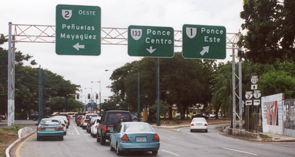
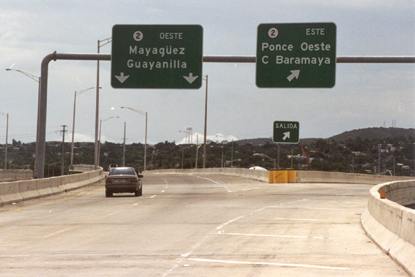
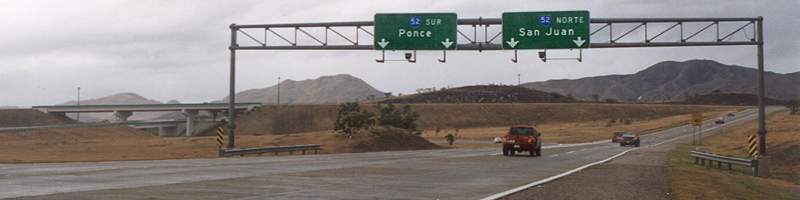
Interstate PRI-2 (San Juan-Ponce via Mayaguez -- PR-22 and part of PR-2)
North end of PRI-2, at PR-18/22/PR-26 junction Alt view of north end of PRI-2, at PR-18/22/PR-26 junction
PRI-2's north end is at this interchange of PR-22/18 with the PR-26 freeway (PRI-3) north of downtown San Juan, shown from two different vantage points over a tunnel portal for PR-22/18.
 
East end of autopista segment of PR-22
South of downtown San Juan, the interchange of eastbound PR-22 (PRI-2) with PR-22/18 northbound into San Juan (continuation of PRI-2), and PR 18 southbound to Caguas (PRI-1). This is the east end of the PR-22 autopista.
 
West end of PR-22 autopista
The west end of the PR-22 autopista at exit 83, where it merges into PR-2, which takes PRI-2 on to Mayaguez and from there back east to Ponce. There are no stub ends in this trumpet interchange. However, there are plans to extend the PR-22 autopista west past Mayaguez then southeast to San Germán, to connect to the free and ultimately controlled-access PR-2 back to Ponce. Construction is underway, though I am unsure of the expected completion date.
 

PRI-2 ends here in southwest Ponce, where PR-2 eastbound joins PR-52 (PRI-1), at the same interchange shown from PR-52 southbound in the PRI-1 photos above.
South end of PRI-2, at PR-2/PR-52 junction
 

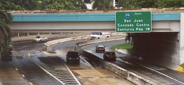
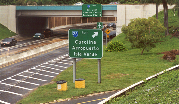
Interstate PRI-3 (San Juan-Ceiba[-Humacao? -Guayama?] --
PR-26, and parts of PR-3 and PR-53)
West end of PRI-3/PR-26, at merge with PR-25
PRI-3's western end is here near Old San Juan, where the PR-26 freeway ends at its junction with PR-25. The photo above is of the 26/25 merge; the photo below is of the traffic signal just after the merge.
Traffic light after west end of PRI-3/PR-26
 
Ramps between PRI-3/PR-26 and PRI-2/PR-22/18
  Two views of the exit ramps onto the PR-22/18 freeway (PRI-2) from PR-26 (PRI-3) westbound, at the same interchange shown above in the photos of PRI-2's north end. Ramp from westbound PRI-3/PR-26 to PRI-2/PR-22/18
 
Turnoff from PRI-3/PR-3 to Roosevelt Roads military base
 

PRI-3's east end used to be in Ceiba, apparently here at this busy intersection of PR-3 (two lanes at this point) with the short access road to the main gate of the Roosevelt Roads military complex at the east end of Puerto Rico.
PR-53/PR-52 junction
Recently (apparently sometime in 2000), PRI-3 was extended along the PR-53 autopista from Ceiba to Humacao (to where PR-53 intersects PR-30) -- though that extension is not reflected in the most recent FHWA Interstate route log (as of October 31, 2002). I found that out after I returned from Puerto Rico, so while I drove through the interchange with PR-30, I did not photograph it.

Only a few scattered fragments of PR-53 beyond Humacao, along the southeast coast to Guayama, have been completed, and they may not yet be part of the Interstate system (though recent updates to some FHWA online documents suggest the remaining completed portions of PR-53 were very recently added to the Interstate system, augmenting Puerto Rico's Interstate mileage by about another 15 miles). As construction is completed on PR-53 (don't hold your breath, construction hasn't yet started on many segments, and some stretches pass through environmentally-sensitive areas), I expect that the remainder of PR-53 will be added to Interstate PRI-3. The interchange shown above, where an open segment of PR-53 west of Guayama connects to PR-52 (PRI-1), either already is PRI-3's southern end if that segment has been added to PRI-3 (pending completion of the middle segments of the autopista), or will be if and when it becomes part of the Interstate. (Contrast digitally enhanced on overhead signs in above photo.)


RETURN TO PAGE 1

Back to Hawaii Highways site

Questions, comments? Please e-mail me.

© Oscar Voss 2002-05.